
Our locations
Two clinics in Mexico: Cancún, Quintana Roo and Playas de Rosarito, Baja California
Cancún
Quintana Roo, Mexico
Address
Ludentistry, Cancún, Quintana Roo, Mexico
GPS coordinates: 21.086522, -86.896979
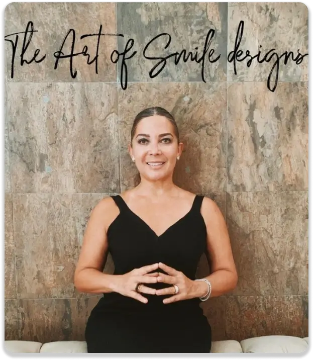
Dr. Lourdes Porras, DDM
Dental Surgeon — Founder of Ludentistry
Over 15 years transforming the smiles of international patients in Cancún.
Estimated travel times
Consider local traffic. We recommend leaving 20 minutes earlier than you think.
Transportation options
Your own car
Parking available in front of the clinic. Follow Google Maps or Waze directions.
Taxi, Uber or DiDi
Services available across the city. Share the Google Maps link with the driver for accuracy.
Hotel transportation
Many of our partner hotels offer complimentary round-trip transportation. Ask at the front desk if they are one of our partners.
Shared van (colectivo)
Budget-friendly option from Av. Tulum and Av. Cobá. Our team can guide you through the site chat if needed.
Parking
Free parking available next to the clinic, subject to availability. We can guide you through the site chat if it is full.
Playas de Rosarito
Baja California, Mexico
Address
C. Derecho de vía de CFE #18501, Local 5, Col. Constitución
ZIP 22710 · Playas de Rosarito, Baja California
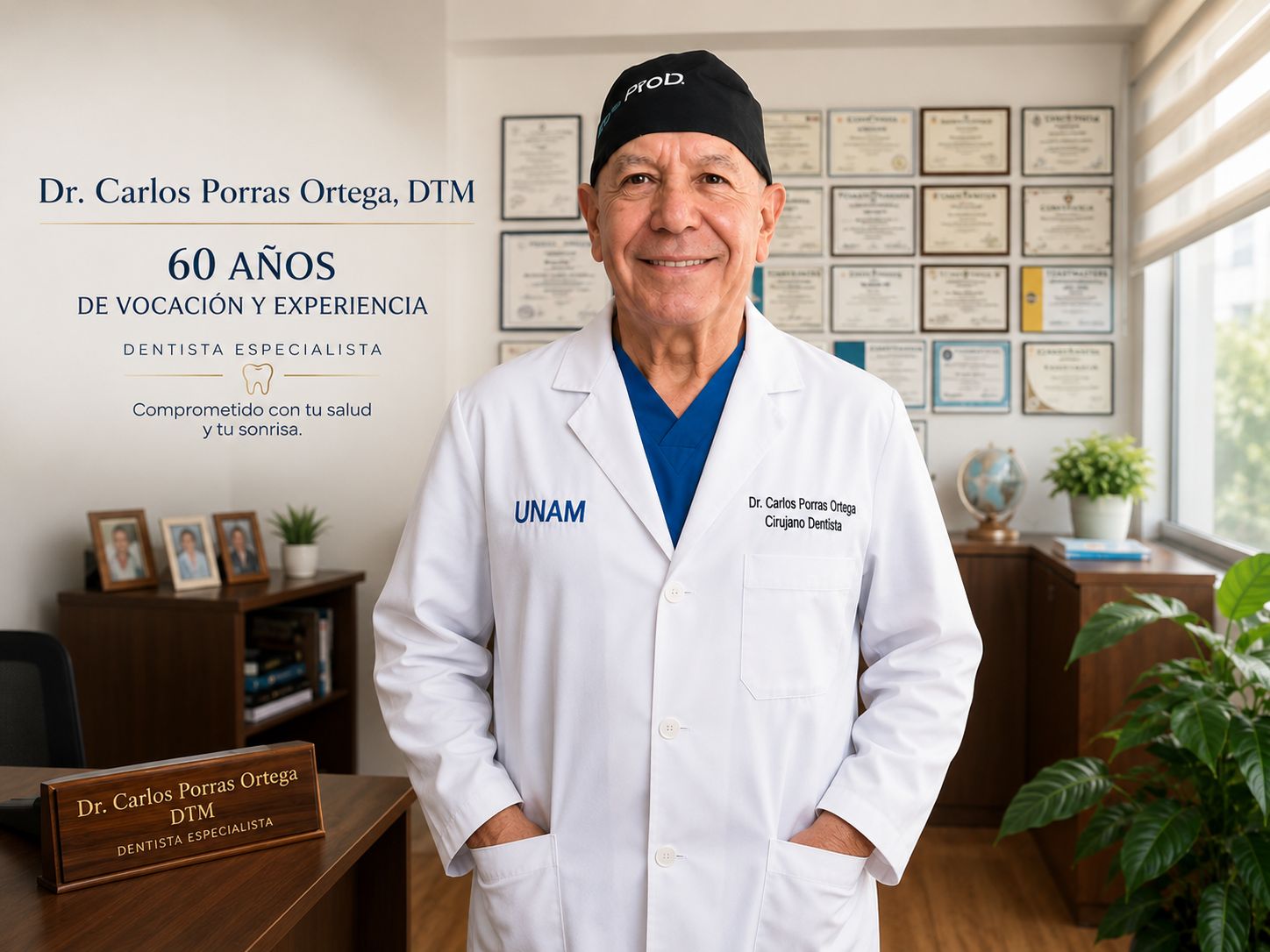
Dr. Carlos Porras Ortega, DTM
Dental Surgeon — UNAM
60 years of vocation and experience. Practices alongside Dr. Lourdes Porras. Committed to your health and your smile.
Estimated travel times
Consider local traffic. We recommend leaving 20 minutes earlier than you think.
Transportation options
By car from the border
Cross at San Ysidro or Otay and take the Scenic Highway toward Rosarito. Parking available at the clinic.
Taxi, Uber or DiDi
Available in Tijuana and Rosarito. Share the Google Maps link with the driver for accuracy.
Cross-border medical tourism
Coming from California? We can guide you on the border crossing and arrival through the site chat.
Parking
Parking available next to the clinic in Col. Constitución, subject to availability.
Parking
Parking available next to the clinic in Col. Constitución, subject to availability. We can guide you through the site chat if it is full.
Already on your way?
Let us know when you leave and we will welcome you without waits. Reach us through the site chat or by phone.